The Geography
The site formerly occupied by the Pruitt and Igoe housing projects is approximately 2 miles northwest of the Gateway Arch in the city of St. Louis, Missouri. The historic site is bounded by Jefferson Avenue, Cass Avenue, 20th Street and Carr Street. This site is located in the DeSoto-Carr neighborhood of the city of St. Louis, now called Carr Square. Directly to the north of the site is the St. Louis Place neighborhood, directly to the west is the JeffVanderLou neighborhood and one block south of the site (south of Cole Street) is the Downtown West neighborhood.
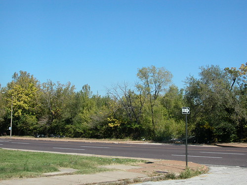
The western and northern sides of the site are bounded by an area of single and multi-family dwellings largely built in the late 19th and 20th centuries. These are now found at lower densities than when these neighborhoods reached peak population in 1950. To the west, vacant lots are interspersed with vacant and occupied buildings. To the north there are very few remaining buildings in the southwest part of St. Louis Place. Much of the area consists of graded vacant lots where grass grows freely. Toward 20th Street are historic neighborhood landmarks like the Mullanphy Tenement (2118 Mullanphy) and the rehabbed Falstaff (originally Columbia) Brewery (20th and Madison streets).
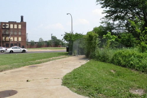
The southern end of the site is bounded by active large concrete warehouse buildings built in the last ten years. The street grid is disrupted and does not fully connect into the Downtown West neighborhood. On the east, the site is largely bounded by the western fence of the St. Stanislaus Kostka Roman Catholic Church property, with just the southeastern corner at DeSoto Park running directly to meet 20th Street. Across 20th Street are the largely two-story, brick-faced apartment buildings of the Murphy Park project, built from 2002-2004 on the site of the high-rise George L. Vaughn Homes. Murphy Park merges into the O’Fallon Place development and the Carr Square Village Apartments, the city’s first public housing project somewhat to the east, to form a nearly-continuous stretch of residential urban fabric from 14th Street west to 20th Street between Cass Avenue and Carr Street.
Site Conditions
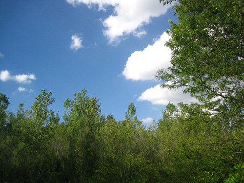
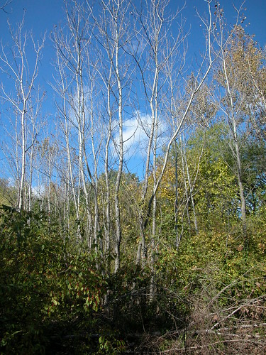
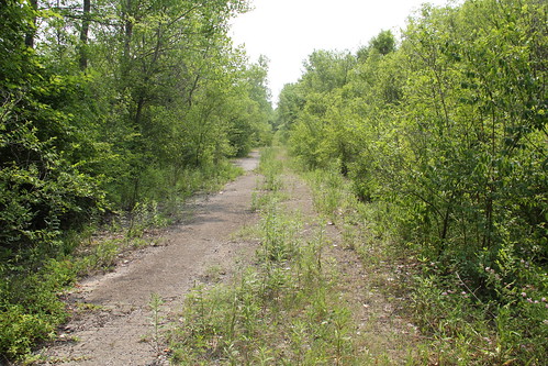
The 74 acres of the Pruitt-Igoe site are divided into several parts, the largest of which are the 33 remaining undeveloped acres of the original 57-acre Pruitt and Igoe housing project site at the north. The undeveloped part of the site is marked by several paths created by remaining sections of streets, access roads and parking areas. the former Dickson Street runs on an east-west axis through the site, connecting with Jefferson Avenue and terminating almost directly behind the sanctuary of St. Stanislaus Kostka. Surrounding these paths on the north and east sides is a large forested area of both deciduous and coniferous trees, shrubs and other plants. Away from the paths, the grading is uneven in the forested areas due to the mounding of fill material brought to the site in the past. This fill includes dirt, gravel, brick and limestone fragments and crushed concrete dumped by the city and taken from other sites. Some rubble from the Pruitt-Igoe buildings remains on site, but it is not visible under the later fill pilings and vegetation.
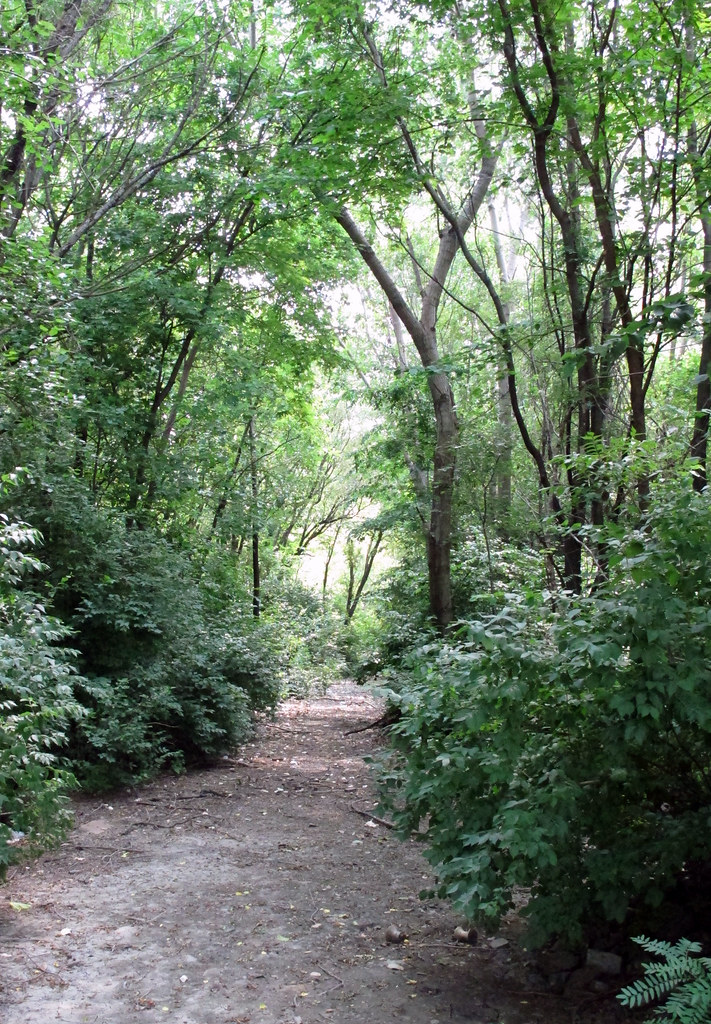
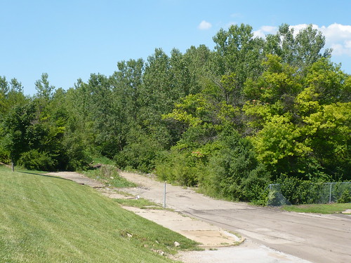
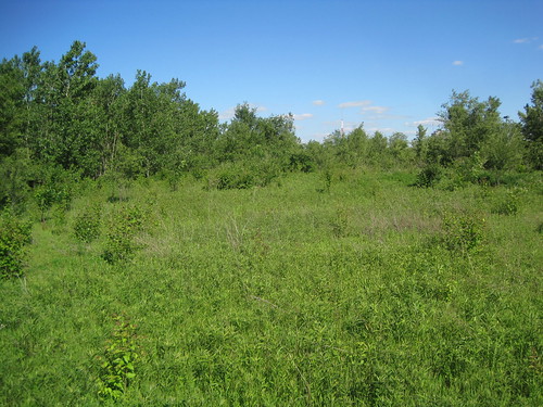
The southern and western parts of the undeveloped section are less forested than the other parts. To the west of the path that reaches Cass Avenue west of 23rd Street, a prairie-like area exists between wooded areas. On the southern end of the site, west of 22nd Street, there is a long section of prairie-like vegetation with some trees growing throughout. These areas mark places where once there were broad lawns between towers. Along all sides of the site are chain link fences. The west and north sides have intact concrete sidewalks interrupted only by remaining cuts for Pruitt-Igoe parking lots and access roads. Trees and vegetation have overgrown the fences on the east, west and north sides. At Dickson Street on the west, the fence is nearly breached and free of vegetation.
On the north side, there is a break in the fence line at the main access road west of 23rd Street, and a smaller breach near 22nd Street. On the south side, the fencing ends at the head of 22nd Street and there is a wide entrance to one of the site’s current paths.
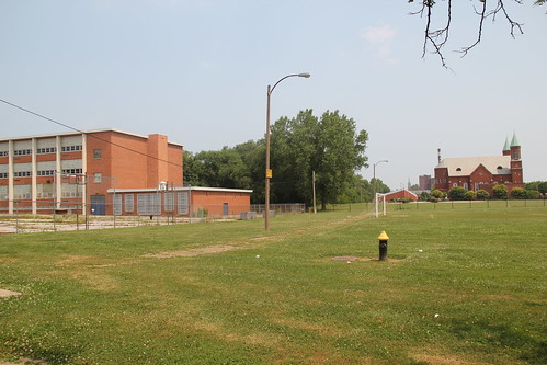
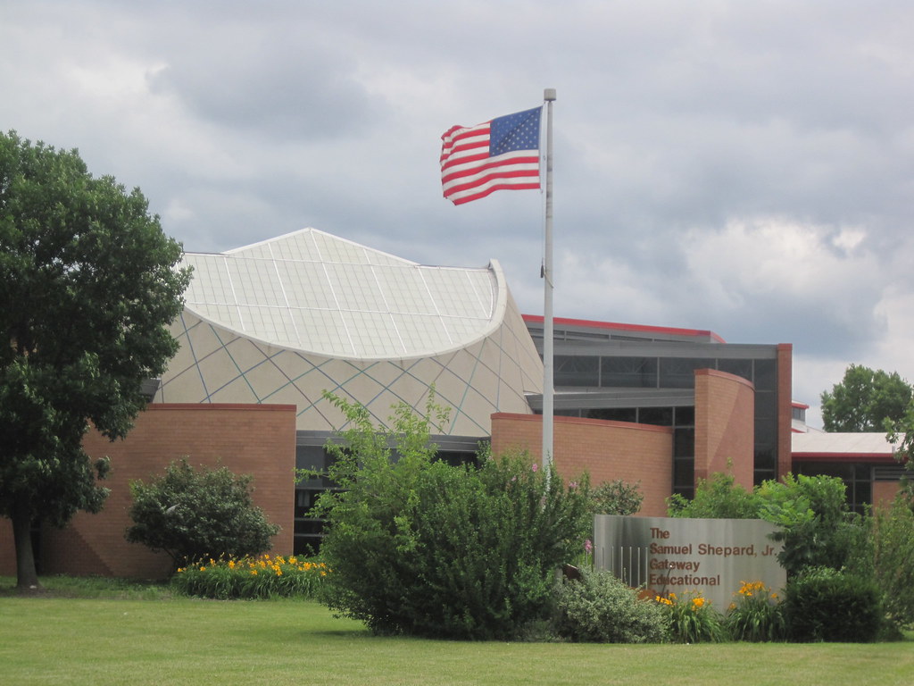
On the south side of the undeveloped section is the Gateway Schools complex west of 20th Street. This site consists of a large parking area, community garden and large laws surrounding two-story educational buildings built around a central courtyard around 1992. East of this site on 20th Street is the compact site of the former Pruitt School.
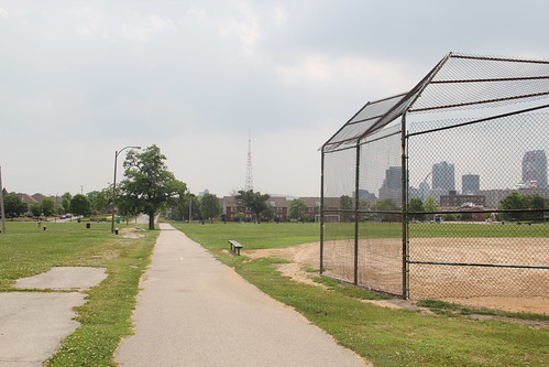
The south and southeastern parts of the site are somewhat uneven grassy areas that constitute DeSoto Park. East of 22nd Street and north of Carr Street, DeSoto Park has a paved elliptical walking path surrounding a field used for soccer games. North of this area is the St. Stanislaus Kostka site, which contains a historic church flanked by two historic secondary buildings, a large contemporary social hall, large paved parking lot and open lawns. All of this site is surrounded by metal fencing. North of St. Stanislaus Kostka is the site of the former Crunden Branch Library.
Current Buildings
Gateway Schools Complex
The Gateway Schools complex is an interconnected group of three public schools (Gateway Elementary School, Gateway Michael School and Gateway Middle School) located on 20 acres that were once part of the Pruitt Homes site. Designed by the Fleming Corporation, the complex consists of one and two-story brick sections built around a two-acre courtyard. Entrances face a parking lot on the northern side of the site. Much of the site is open, and includes a shelter, playground and vegetable garden. The St. Louis Public Schools selected the site in 1989 and broke ground in 1994. The three schools opened on September 5, 1995.
The Remainders
Buildings
Although the thirty-three towers are gone, several buildings still extant on the site were part of the historic built environment of Pruitt-Igoe:
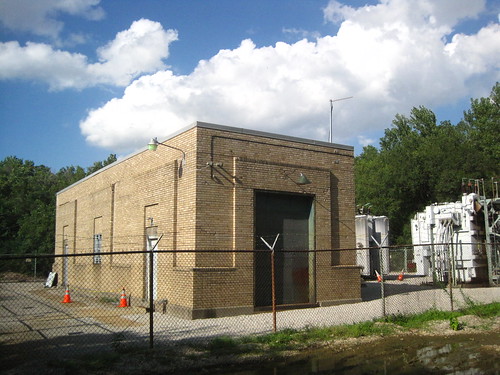
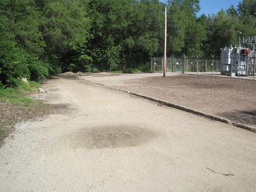
Electric SubstationThe Electric Substation south of Cass Avenue and west of 23rd Street is a one-story brick building built in 1954 to serve the complex. It remains in use and was designed by Hellmuth, Yamasaki & Leinweber. The Substation and the fenced yard of transformers to its east are owned by Ameren Corporation. |
 |
Pruitt School(1212 N. 22nd Street): Pruitt School was built in 1955 to serve the families of Pruitt-Igoe. F. Ray Leimkuehler was the architect. The two-story brick and stone building with one-story attached gymnasium currently serves as a Junior Naval Academy. |
 |
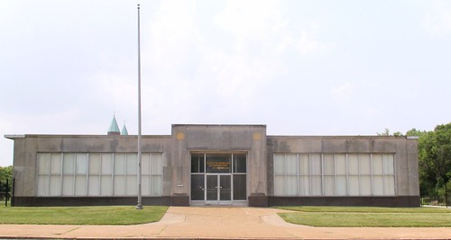
Crunden Branch Library(2008 Cass Avenue): At the southwest corner of Cass and 20th Streets is the former Crunden Branch Library, built in 1959 to serve Pruitt-Igoe. Joseph Senne designed the one-story stone-faced building, which is now in use as a church. |
 |
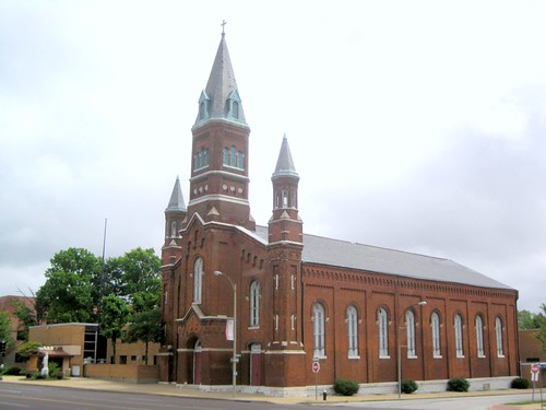
St. Stanislaus Kostka Roman Catholic Church(1413 N. 20th Street): Built in 1896 and designed by Louis Wessbecher, the brick sanctuary of St. Stanislaus Kostka remains in use today and is one of the few 19th century buildings in DeSoto-Carr still standing. It is flanked by two earlier two-story brick buildings and is near a one-story social hall dating to the late 1990s. |
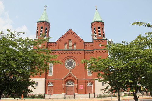 |
St. Bridget of Erin Roman Catholic Church and Central Catholic School and Academy(1106 N. Jefferson Avenue): St. Bridget of Erin Roman Catholic Church at the northeast corner of Carr and Jefferson was built in 1860 and is one of the oldest churches in the city. Adjacent to the church is a two-story brick school dating to the 1950s that remains in use as a parochial school. |
 |
Around the site are several buildings with significant connections to Pruitt-Igoe:
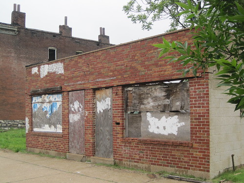
Pruitt Igoe Neighborhood Station(2411 Cass Avenue): Built in 1956 as Richardson’s Delicatessen, this one-story concrete block building with tapestry brick front elevation served as the Pruitt-Igoe Neighborhood Station and Model Cities Office from 1966 through 1969. The Urban League used a federal Model Cities grant to purchase this building and operate it as a center staffed with social workers and planners intent of fixing the social fabric of Pruitt-Igoe. The building currently is vacant. |
 |
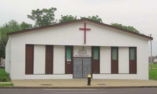
Grace Baptist Church(2319 Cass Avenue): This one-story concrete block building was built as Keller’s Supermarket in 1956. In 1971, Grace Baptist Church moved from an adjacent building into this one. This building can be seen in aerial footage of Pruitt-Igoe before its demolition and has changed little since then. |
 |
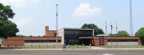
Jefferson-Cass Health Center(1421 N. Jefferson Avenue): Now the headquarters of the St. Louis Fire Department, this one-story Modern Movement brick, stone and concrete building west of the site was built as a municipal health clinic to serve residents of Pruitt-Igoe and surrounding neighborhoods. Marcel Boulicault designed the building. The clinic offered comprehensive child health care, prenatal classes, obstetrics and family planning, X-rays and TB treatment. |
 |
Landscape
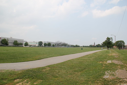
DeSoto Park: Located at the south end of the Pruitt-Igoe site is DeSoto Park, which contains 17.38 acres. The LCRA developed DeSoto Park to serve residents of the Pruitt, Igoe and Vaughn housing projects; today the park continues to serve residents of surrounding neighborhoods. DeSoto park contains soccer fields, a baseball field, a paved trail and open lawn space with few trees. The park’s name comes from the name of the DeSoto neighborhood that Pruitt and Igoe replaced.
Infrastructure
The Pruitt-Igoe site retains other parts of the historic building environment:
Paving
In many places, Dickson Street reveals weather-worn asphalt paving that dates to the final days of Pruitt-Igoe. Additionally, aggregate concrete access roads around the Electric Substation are nearly fully revealed. A road that runs east from the north end of the Electric Substation has substantial extant concrete paving under a layer of mud. At the east end, running north is a curving formation between Cass Avenue and Dickson Street under mud and gravel is more historic concrete paving.
Curbs
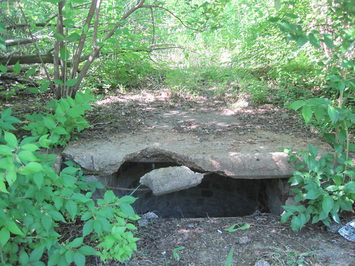
Around the Electric Substation and at some points on Dickson Street, worn concrete curbs remain. On the north side of Dickson Street just west of the main access road by the Electric Substation, an original storm drain remains evident.
Sidewalks
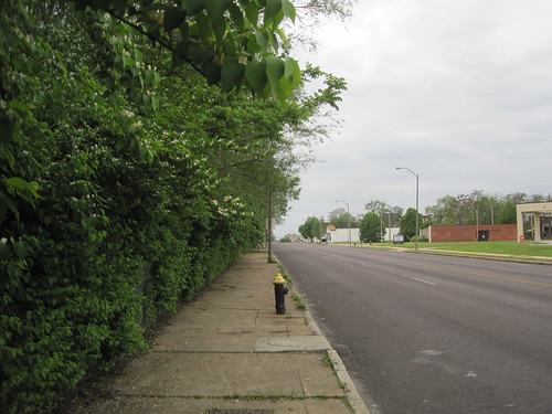
All of the sidewalks, curb cuts and curbs along Cass Avenue and Jefferson Avenue are historic to the site.
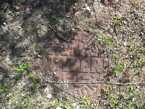
Manhole covers
Several manhole covers can be seen on Dickson Street and even in some of the wooded parts of the site.
Metal post
A metal post with intact padlock that once served to secure a parking area in front of a tower remains in the northeast wooded area.
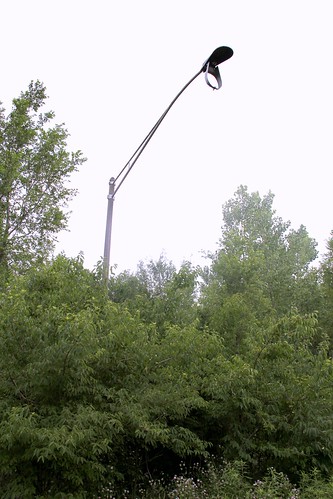
Street light
South of Dickson Street near the Gateway Schools site, an aggregate concrete post with metal overhead light structure remains in a thicket of trees.